Solutions
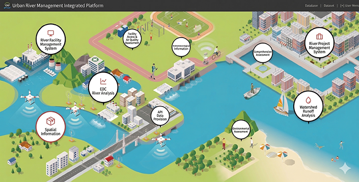
Smart City
geoCRP Platform for Smart River Management Operations
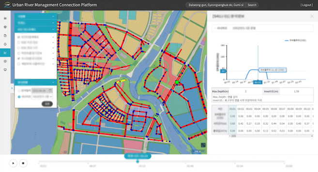
The geoCRP platform collects river observation and spatial data to support efficient river management and enables a wide range of analyses and evaluations based on the collected information. Analysis and evaluation results are intuitively visualized through graphs, tables, and maps, and the data is made available via RESTful APIs for external system integration.

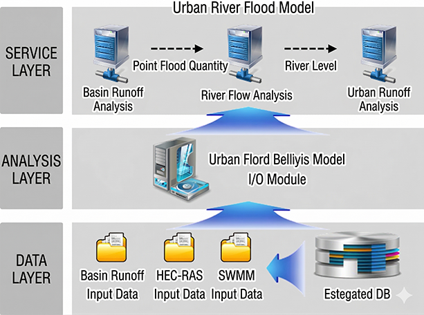
System Architecture
River Information API Development
- Design and development of APIs by data category
- API interface testing and validation
- Controlled access through API key issuance
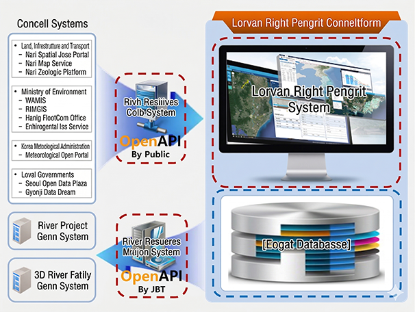
Flood Model River Data I/O Module Development
- Analysis of flood model input and output data items
- Analysis of flood model input/output structures
- Development of input file generation and output result inquiry modules for flood models
Key Features
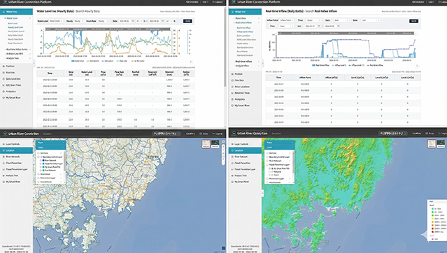
[Data-Driven Customized Visualization of River Information]
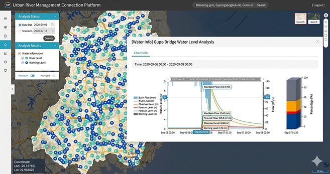
[Smart City Flood Analysis – Watershed Runoff Analysis]
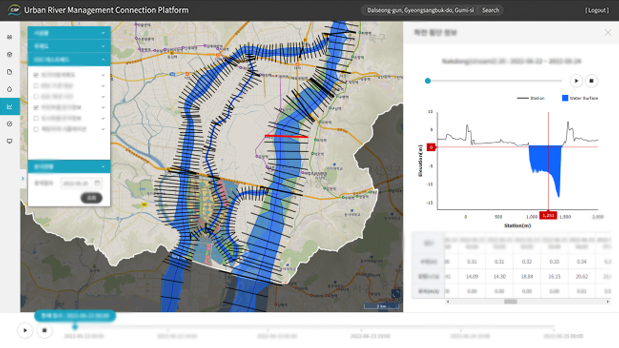
[River Flow Analysis: HEC-RAS Based]
[Urban Runoff Analysis: EPA SWMM Based]