
ICT Platform

We provide ICT platform development services by combining industry-specific consulting expertise, extensive cross-domain development experience, and the integration of the latest technologies.
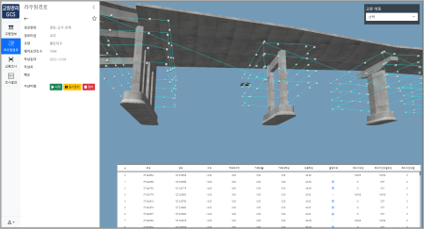
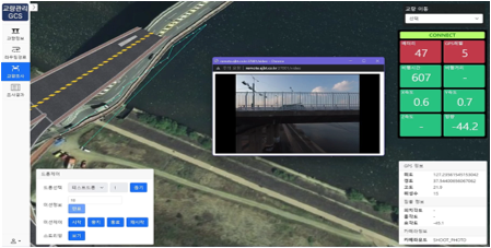
IoT Platform-Based Continuous Monitoring System for Steep Slopes in Gangwon Province
By applying an IoT platform solution, this project establishes an integrated monitoring system that efficiently manages on-site measurement equipment and sensor data from steep slopes, enabling real-time data collection and management.
-
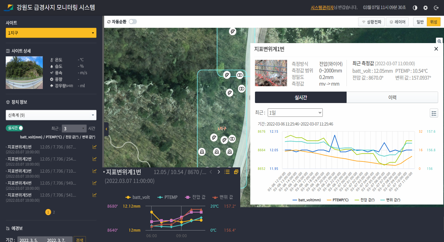 Visualization of real-time IoT sensor measurement data
 -
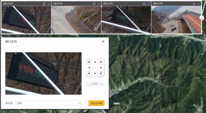 CCTV visualization and PTZ control
 -
 Event detection and situation dissemination
 -
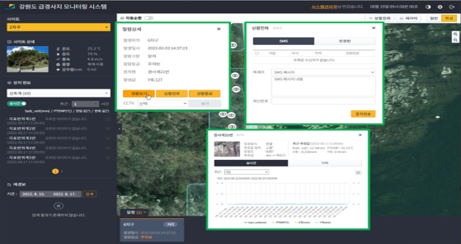 Historical inquiry of on-site measurement data
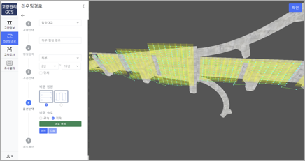
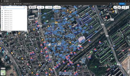
Waypoint-Based Drone 3D Routing System Implementation
This platform derives and visualizes optimal flight paths for unmanned aerial vehicles (UAVs) by considering both dynamic and static ground obstacles, with the objective of minimizing potential damage in the event of a crash.
-
 3D routing system implementation
 -
 3D routing system implementation
 -
 3D routing system implementation
 -
 3D routing system implementation
Smart Wireless Network Deployment for Republic of Korea Navy Aviation Base
Utilizing Fourth Industrial Revolution technologies such as LTE and IoT, this project establishes a dedicated military LTE-based wireless network for a Navy aviation base. The system includes independent LTE infrastructure components—base stations, indoor/outdoor repeaters, EPC, EMS, call servers, and MCPTT—to support secure and efficient base operations.
-
 Real-time PTT terminal location monitoring
 -
 Configuration of diverse disaster alert and warning scenarios
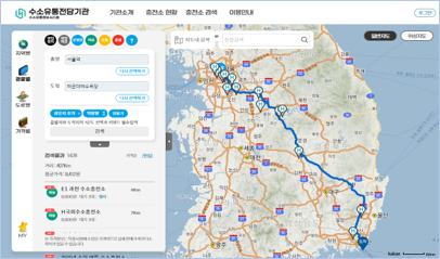
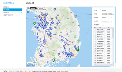
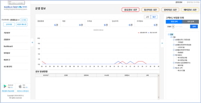
Hydrogen Optimal Distribution Network & Real-Time Information Disclosure Platform
This project delivers a public-facing real-time information disclosure system for hydrogen refueling stations, including pricing and operational data, supporting the role of a dedicated hydrogen distribution authority. It also establishes an optimal distribution network decision model to minimize hydrogen transportation costs.
-
 Real-time PTT terminal location monitoring
 -
 Configuration of diverse disaster alert and warning scenarios
 -
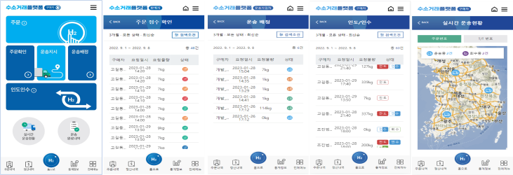 Mobile application interface for real-time hydrogen distribution operations
Integrated Building Facility Operations Platform for Samsung S1
By implementing four core facility monitoring and control functions across web and mobile services, this platform delivers meaningful operational insights to clients and administrators while establishing a structured data collection foundation.
-
 Site-based operational status dashboard
 -
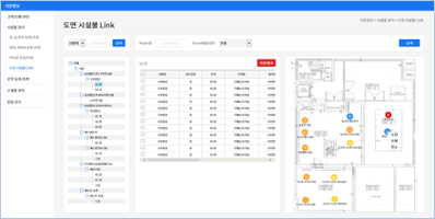 Facility and drawing management by site
 -
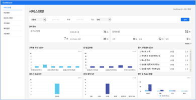 Service status dashboard by site
 -
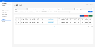 Schedule management interface by site
SWIM Platform Testbed Development
This project establishes a SWIM (System Wide Information Management) platform testbed to enable integration and delivery of next-generation aeronautical information services.
-
 Real-time flight operation information display
 -
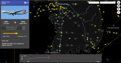 Search and guidance for real-time flight information by aircraft
 -
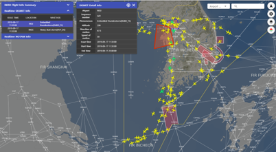
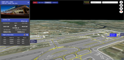 3D-based real-time aircraft information by airport nationwide
 -
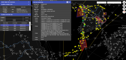 Real-time NOTAM alert interface for flight operations