
R&D

To expand smart disaster management R&D initiatives and secure future growth engines, the Smart Disaster Management Research Institute was established. We possess core technologies for spatial data processing and analysis utilizing LBS, ICT, IoT, and Big Data, and conduct research and development across the entire spectrum of geospatial services and solutions, including spatial data production and transformation, GIS platform development, and the delivery of proprietary solutions.
Urban River Basin Integrated Platform Development
Meteorological, hydrological, spatial, and river facility data are stored in an integrated database and provided via Open APIs. Urban river flood control, waterfront, environmental assessment, and flood evaluation models developed within the research consortium are modularized to enable web-based operation and service delivery.
-
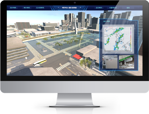
 Main service interface
 -
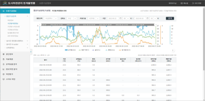 Customized visualization services by data characteristics
 -
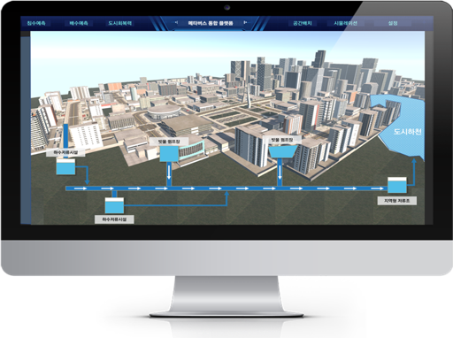
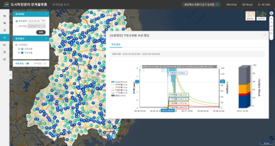 River runoff analysis and result visualization
 -
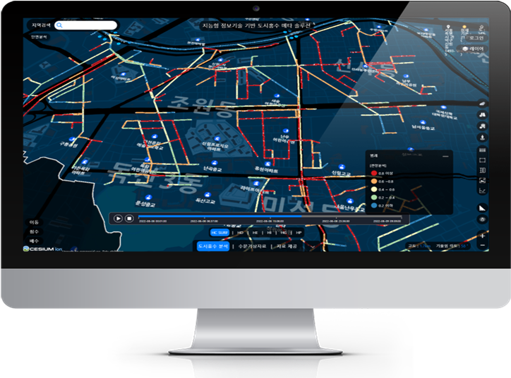
 River flow analysis and result visualization
Urban Flood Analysis and Prediction Technology Development
To mitigate and recover from urban flood damage, this project integrates and links information using ICT technologies, while developing virtual indoor and outdoor spatial measurement technologies and 3D spatial design techniques for complex, irregular structures.
-
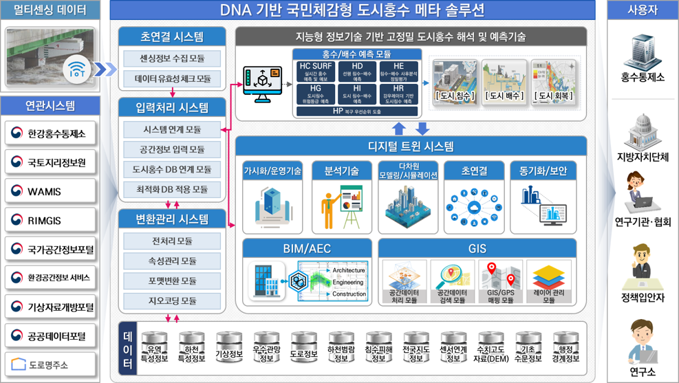 Target architecture of the urban flood prediction system
 -
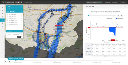
 Localized flash flood prediction service
 -
 Stormwater drainage network monitoring service
 -
 IoT-based flood risk zone prediction service
 -
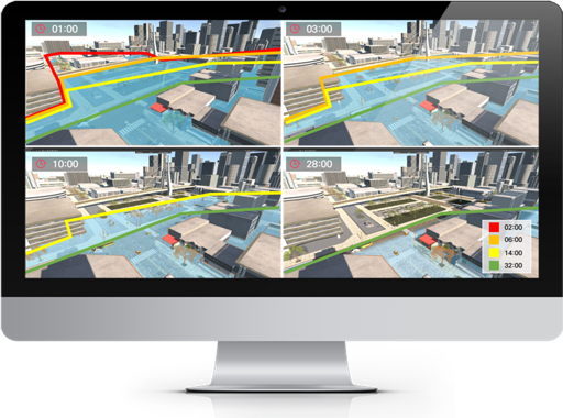 Flooding and drainage time prediction analysis
Soil Function Restoration Evaluation System Development
This system visualizes information across the entire lifecycle of topsoil restoration—from site selection to post-restoration evaluation and management—and provides analytical functions for pre- and post-assessment as well as restoration method selection to support informed decision-making.
-
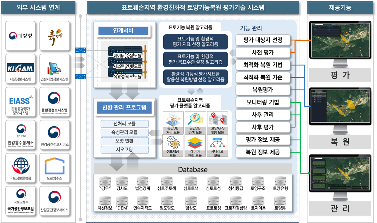 Target architecture of the post-restoration soil evaluation system
 -
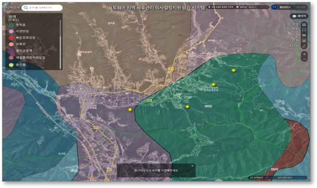 Selection of evaluation target locations
 -
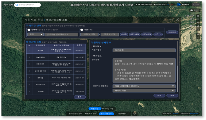 Implementation of soil function restoration techniques
 -
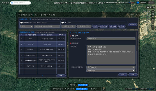 Monitoring of soil function restoration performance
 -
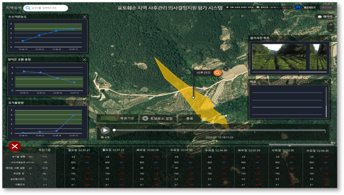 Post-evaluation monitoring history inquiry
Fire Protection Facility Evaluation Platform Development
This integrated fire protection facility evaluation platform introduces a fire protection design system to assess installation requirements and adequacy by building usage. It enables systematic, quantitative evaluation of fire protection facilities, improving upon traditional manual drawing-based inspection methods.
-
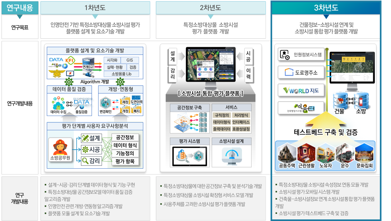 Target architecture of the fire protection facility evaluation platform
 -
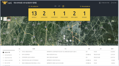 Main interface of the fire protection facility evaluation platform
 -
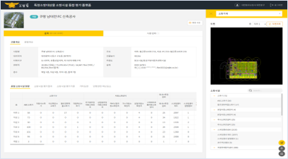 Fire protection facility status by floor
 -
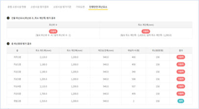 Life safety evacuation factor evaluation
 -
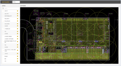 Floor plan and fire protection facility information