
Digital Twin

JBT’s digital twin technology converges diverse facilities, equipment, and spatial data into an intuitive IT solution, creating a 3D-driven, real-time decision-making framework. Powered by high-precision virtual modeling, our system provides comprehensive, real-time visibility. When emergencies or facility failures occur, it maximizes operational responsiveness through automated alerts and interconnected support. Ultimately, we deliver a "blind-spot-free intelligent spatial safety platform" that ensures swift, data-driven decisions across all managed zones.
Integrated Monitoring for Large-Scale Public Infrastructure & Multi-Use Facilities
By providing real-time visibility, automated alerts, and streamlined support, we take emergency response to the next level, creating an impenetrable, multi-dimensional safety net for your facilities.
-
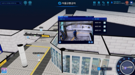
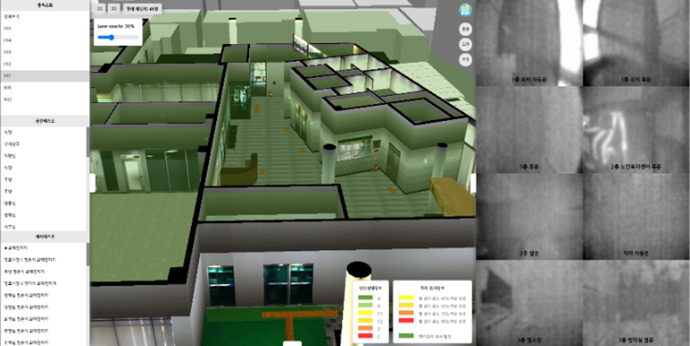
 Comprehensive Monitoring & Real-Time Asset Management
 -
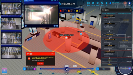
 Intelligent Situation Analysis & Automated Response Support
 -
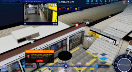
 Integrated Alarm Event Logging & History Management
 -
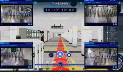
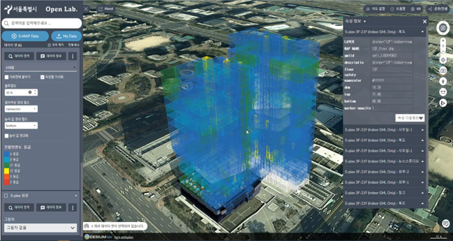
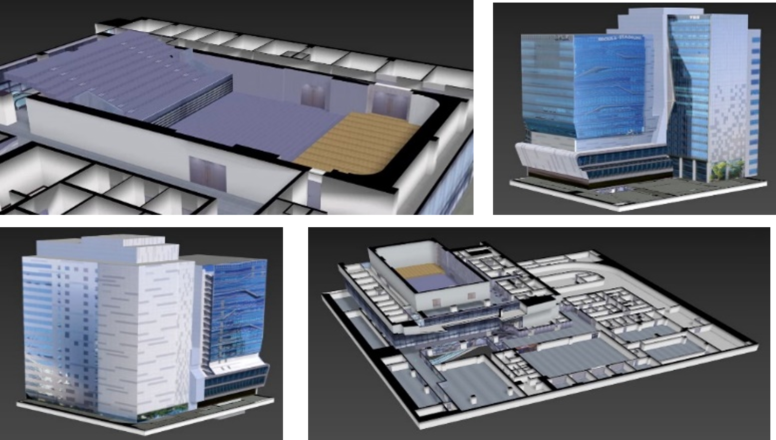
 Large-Scale Facility Monitoring & Control System
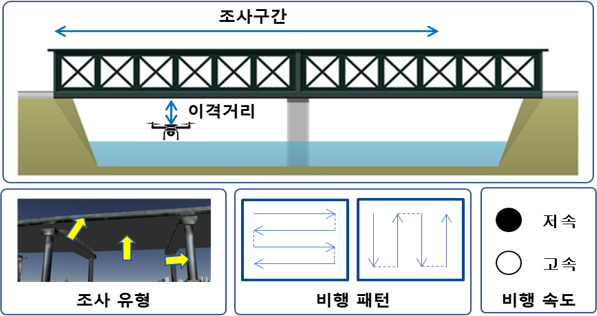
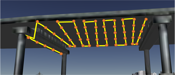
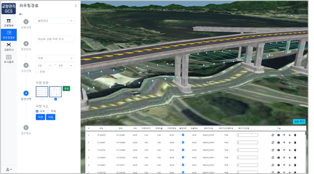
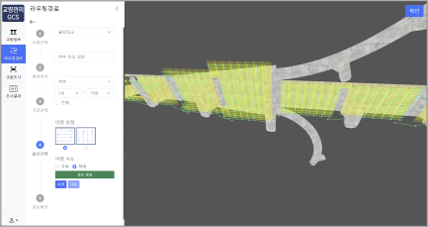
Waypoint-Based Drone 3D Routing System Development
Through the development of a DNA-based smart maintenance platform for aging bridge structures, this project delivers a service platform for creating and managing drone 3D routing paths and establishes a robust network environment to minimize data gaps during drone-based inspections.
-
 Drone 3D routing system
 -
 Drone 3D routing system
 -
 Drone 3D routing system
 -
 Drone 3D routing system
Development of Immersive, Customized Disaster Management Content Based on 3D Spatial Information
This project establishes a real-time safety status and integrated disaster management information platform to deliver customized disaster situation management and response scenario services based on 3D spatial information.
-
 Customized content based on 3D spatial information
 -
 Customized content based on 3D spatial information
 -
 Customized content based on 3D spatial information
 -
 Customized content based on 3D spatial information
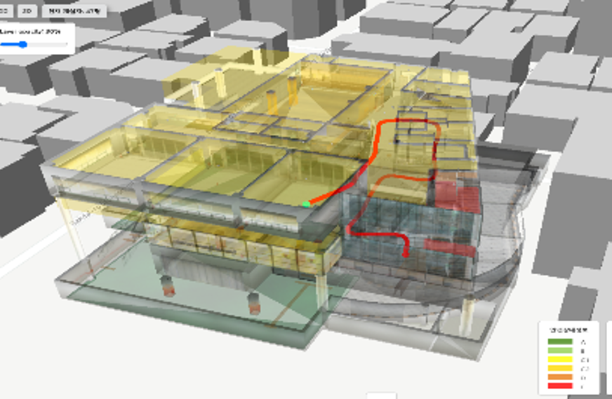
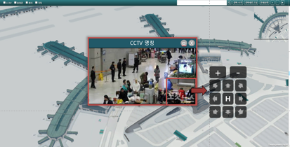
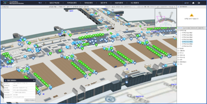
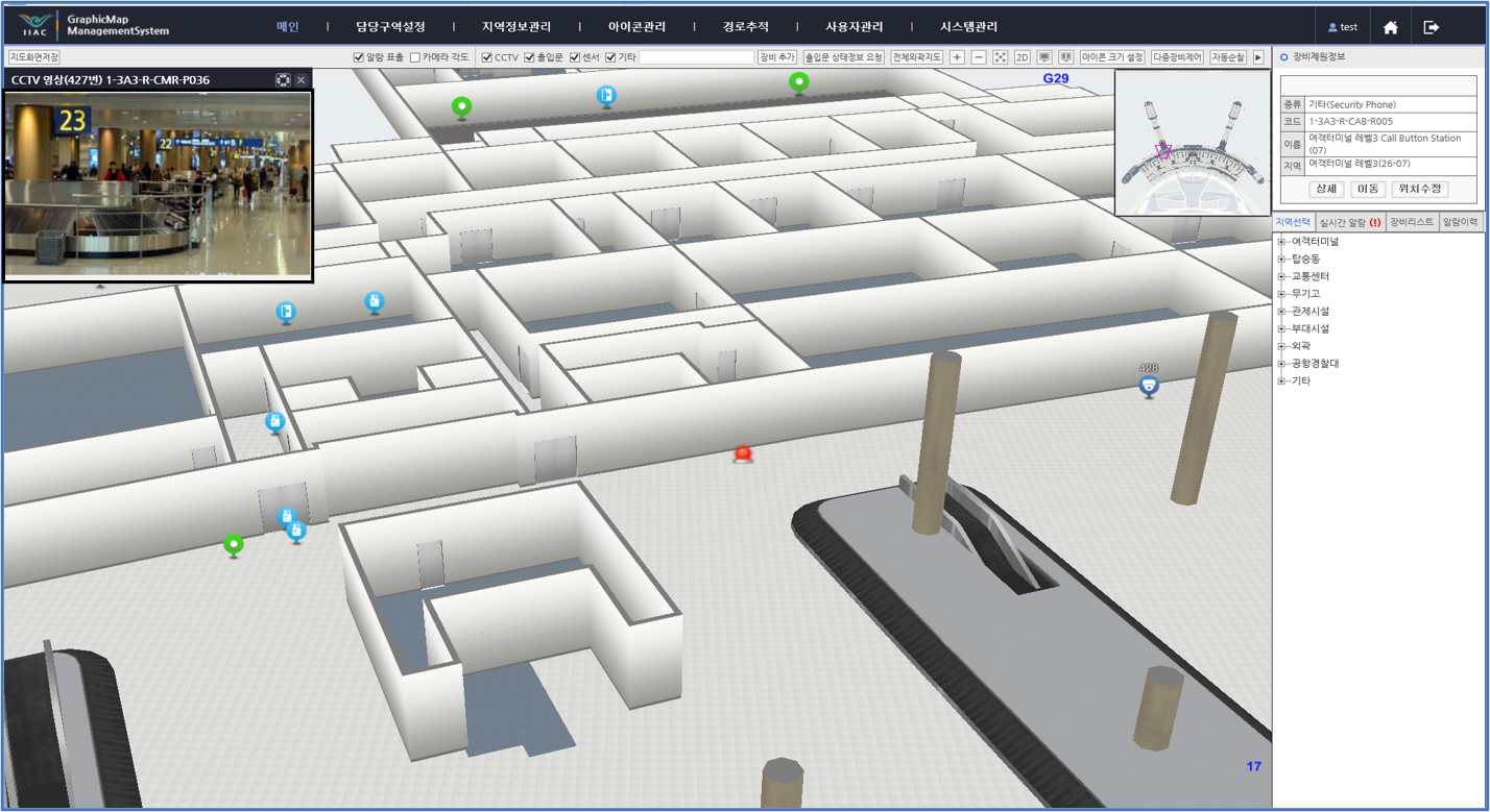
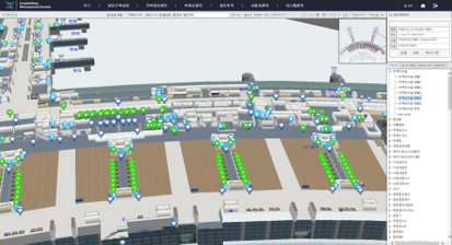
Integrated Counter-Terrorism Situation Management System for Incheon International Airport Passenger Terminal
This system delivers integrated information essential for counter-terrorism operations, including monitoring and control of various IoT sensor data, surveillance and route tracking of unauthorized intruders, automated patrols in high-risk areas, automatic door control, and emergency dispatch alert services for security personnel.
-
 Integrated counter-terrorism situation management system
 -
 Integrated counter-terrorism situation management system
 -
 Integrated counter-terrorism situation management system
 -
 Integrated counter-terrorism situation management system