
Disaster Safety

As a core system designed to enable accurate fact-finding and rapid initial response for proactive and agile disaster prevention and response toward realizing a “Safe City,” this platform provides big data collection and storage for disaster risk management, GIS-based integrated monitoring of disasters and incidents, and location-based disaster alerting and scenario-driven response functions.
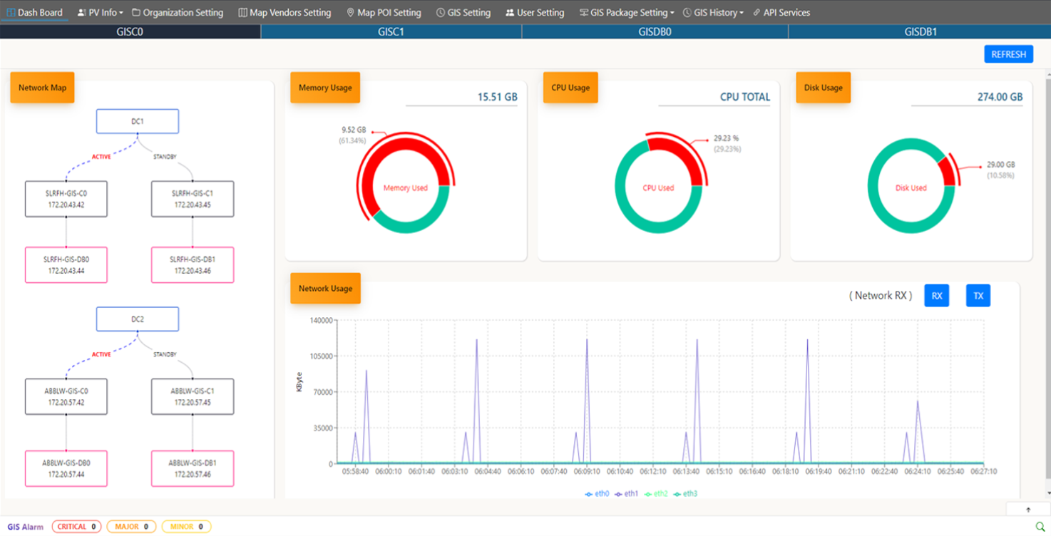
National Disaster and Safety Communication Network Development Project
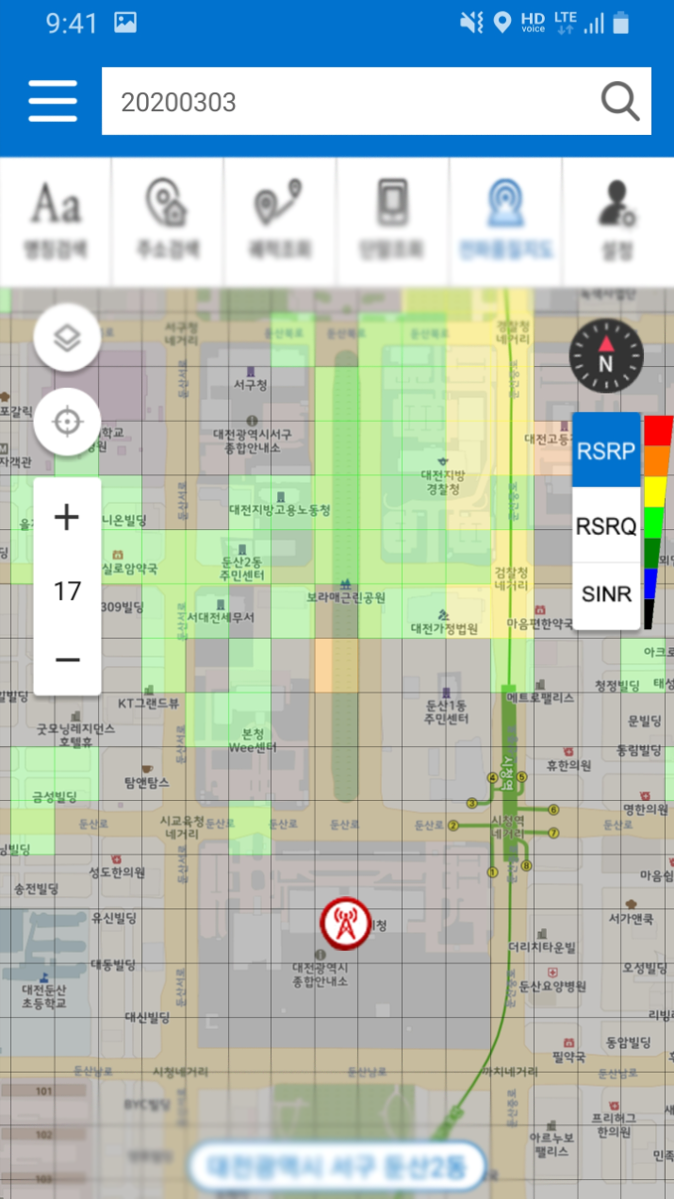
This system applies GIS-based nationwide device location management, base station location and status data, radio quality information at 50-meter resolution, and a geofencing solution for dynamic call group management, enabling automatic call group configuration based on spatial and location data.
-
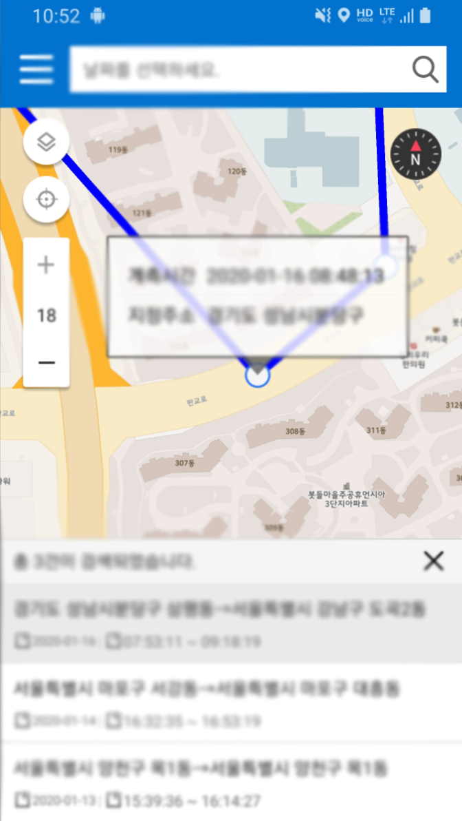
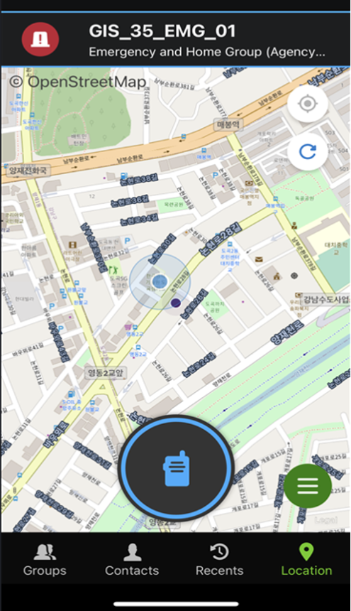
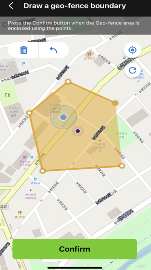
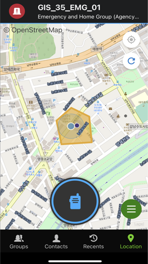
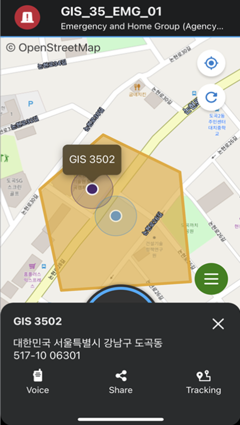
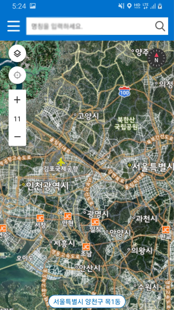 Disaster network mobile geospatial information service interface
 -
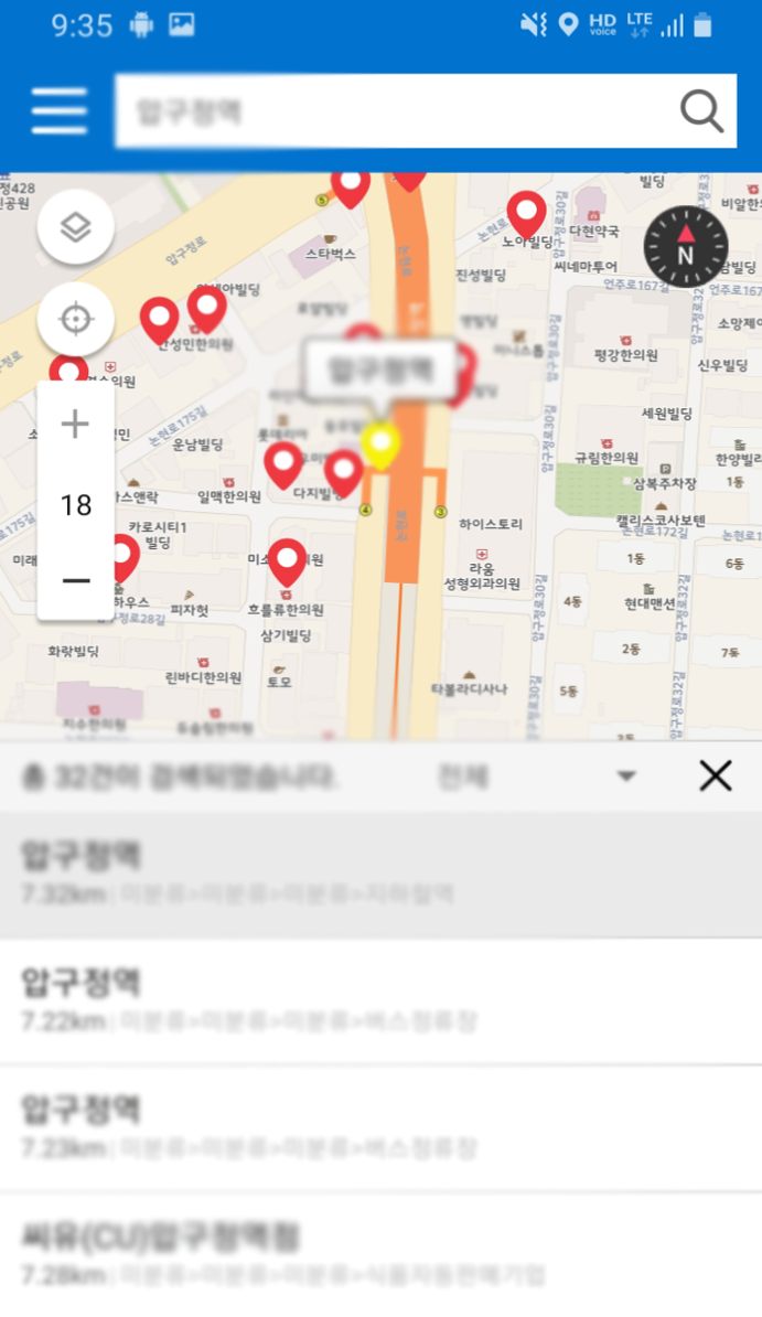 Disaster network mobile geospatial information service interface
 -
 Disaster network mobile geospatial information service interface
 -
 Disaster network mobile geospatial information service interface
MCPTX Service Based on TELUS PS-LTE Network (Canada)
Among TELUS’s PS-LTE systems in Canada, we developed and delivered GIS solutions, enabling core functions such as real-time PS-LTE device tracking, movement history analysis, and geofencing.
-
 Control center situation dashboard service
 -
 Control center situation dashboard service
 -
 Mobile location monitoring service
 -
 Mobile location monitoring service
 -
 Mobile location monitoring service
 -
 Mobile location monitoring service
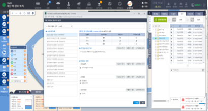
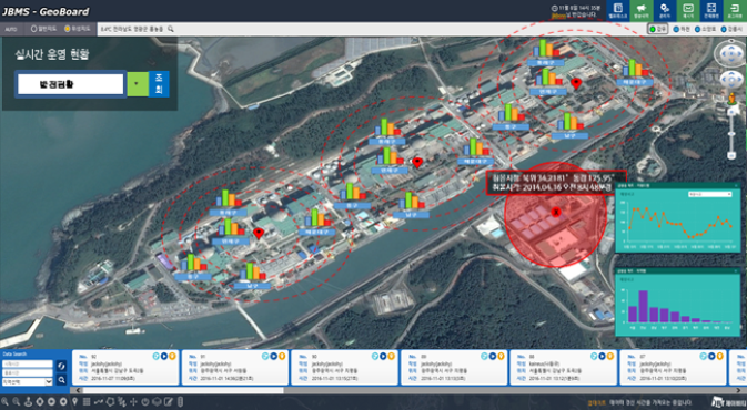
Daejeon Metropolitan City Intelligent Disaster Early Warning System Project
This project builds a core system for accurate fact-finding and rapid initial response, enabling proactive and agile disaster prevention and response toward realizing a “Safe City.”
-
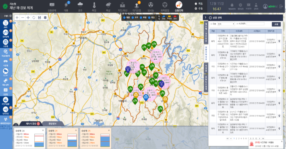 Real-time information on various disaster-related facilities
 -
 Configuration of diverse disaster alert and warning scenarios
Integrated Disaster Safety Smart Control Center for Kangwon Land
Implemented through the JBMap Suite geoBoard solution, the Kangwon Land disaster management system classifies and disseminates disaster situations into levels such as interest, caution, alert, and severe.
-
 Smart disaster situation monitoring
 -
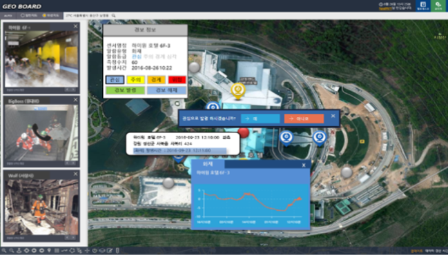 Live on-site video streaming
Radiological Emergency Command Center for Korea Hydro & Nuclear Power
KHNP’s disaster early detection and response platform integrates real-time power generation data with weather conditions, intake/discharge water temperature and salinity, environmental radiation levels, and live on-site video streaming across four nuclear sites—Hanbit, Hanul, Uljin, and Gori—establishing a system for rapid disaster response within the golden time.
-
 Smart disaster situation monitoring
 -
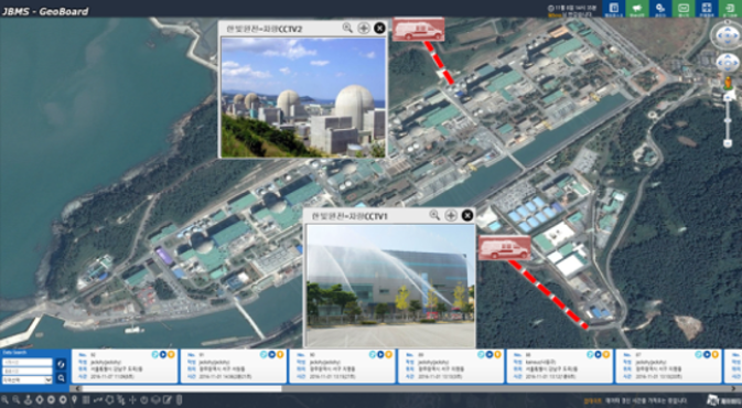 Live on-site video streaming
Overseas Remote Water Management System Deployment (Thailand, Pakistan, Iran)
In conjunction with IoT-based sensor technologies, this solution analyzes various observation data and real-time monitoring information and delivers them through the geoBoard dashboard in an integrated service format.
-
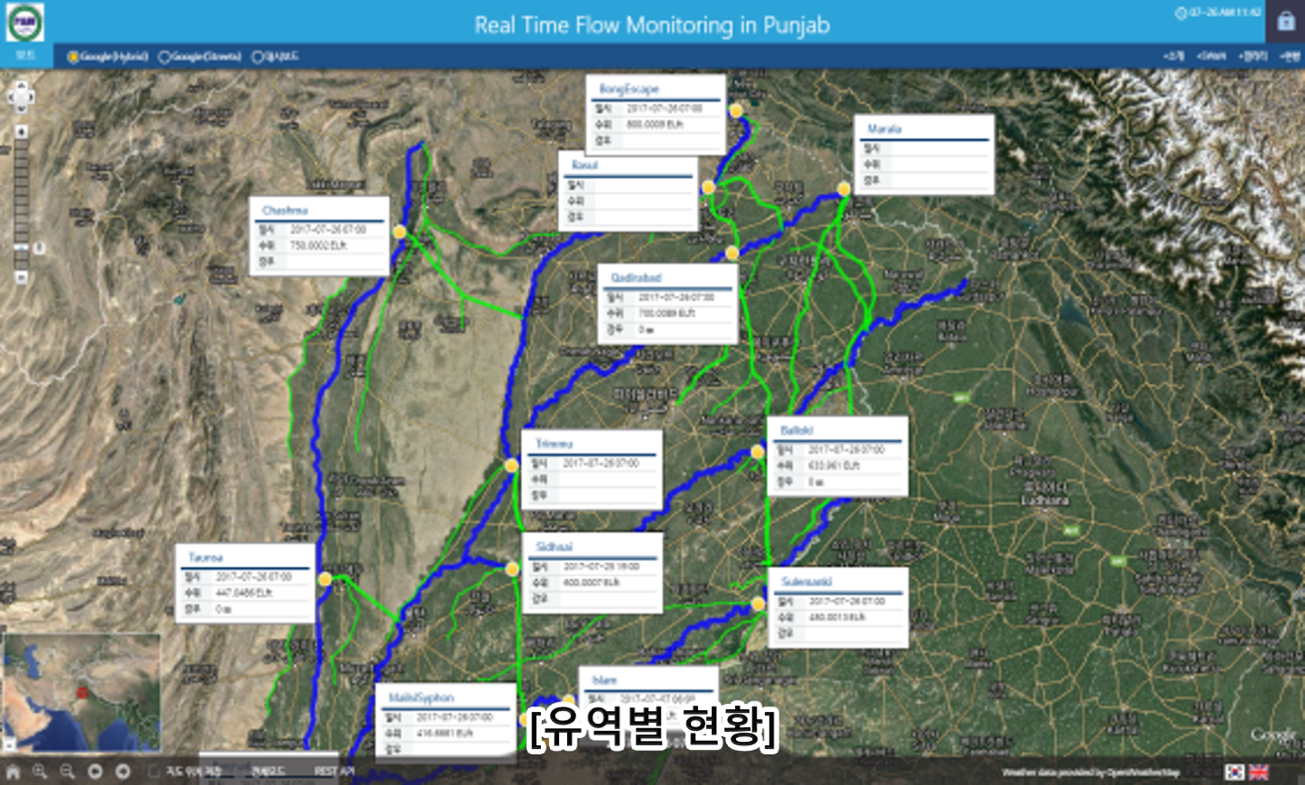 Watershed status overview
 -
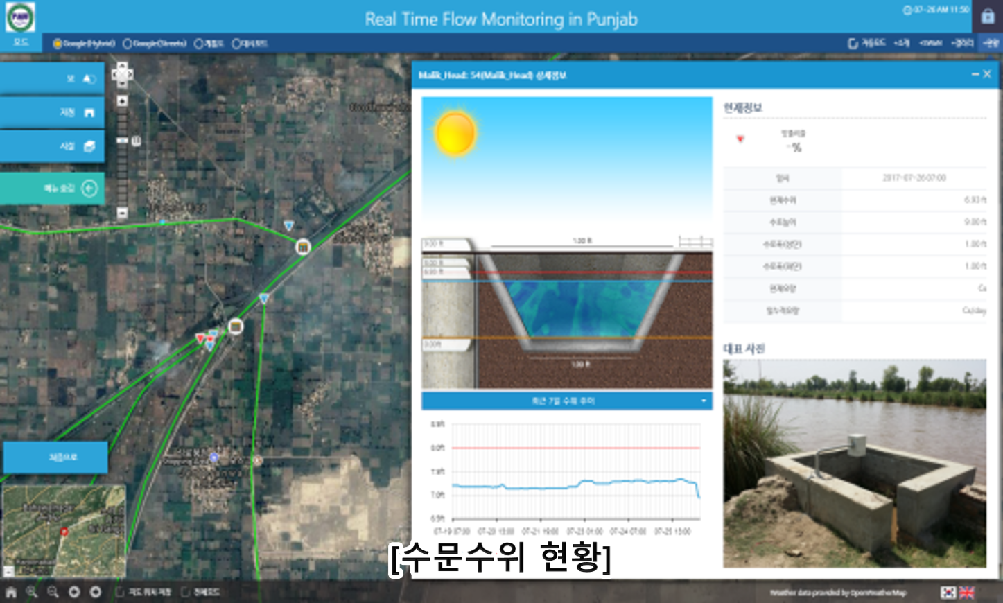 Water gate and water level status