GIS Package
geoWorks SDK for Spatial Map Services
This platform enables the visualization of diverse spatial information contents on maps and allows users to easily apply styling through intuitive tools, empowering them to create customized maps. Configured content can be immediately utilized for various service purposes.
Key Features
- Support for WMS functionality (image generation based on GIS data)
- Multi-dimensional data handling (elevation, time)
- Real-time map design application
- Support for 3D buildings and DEM data from open platforms (VWorld)
- Native BaseMap specification support for offline environments
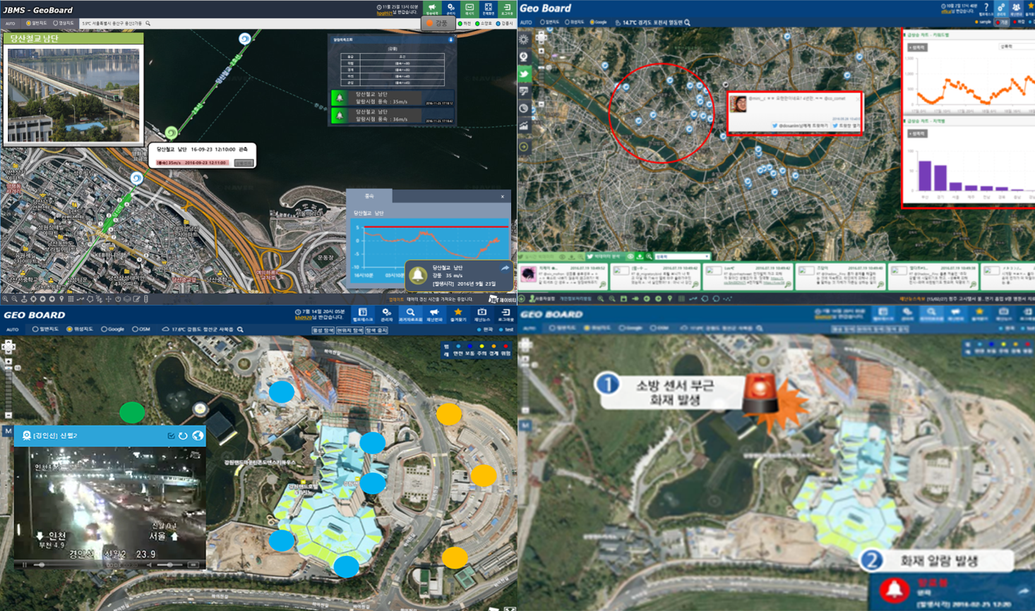
Spatial Map Dashboard geoboard
By establishing a real-time, location-based smart integrated situation management platform, this solution collects and analyzes on-site monitoring data through integration with various CCTV systems and IoT sensors, and provides field-oriented integrated situation management and response services through embedded disaster and risk prediction models.
Key Features
- Content management
- Menu management
- Weather information services
- Key location CCTV services
- Scenario management
- Real-time streaming management
- Historical weather data inquiry
- User-defined spatial data management
- Wearable device integration
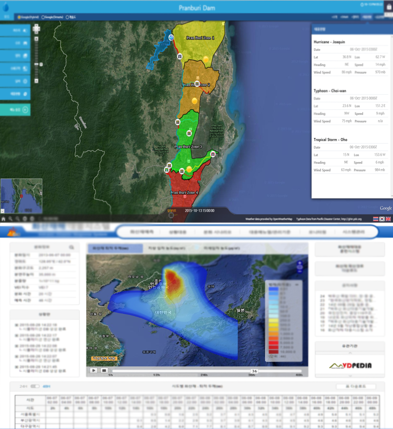
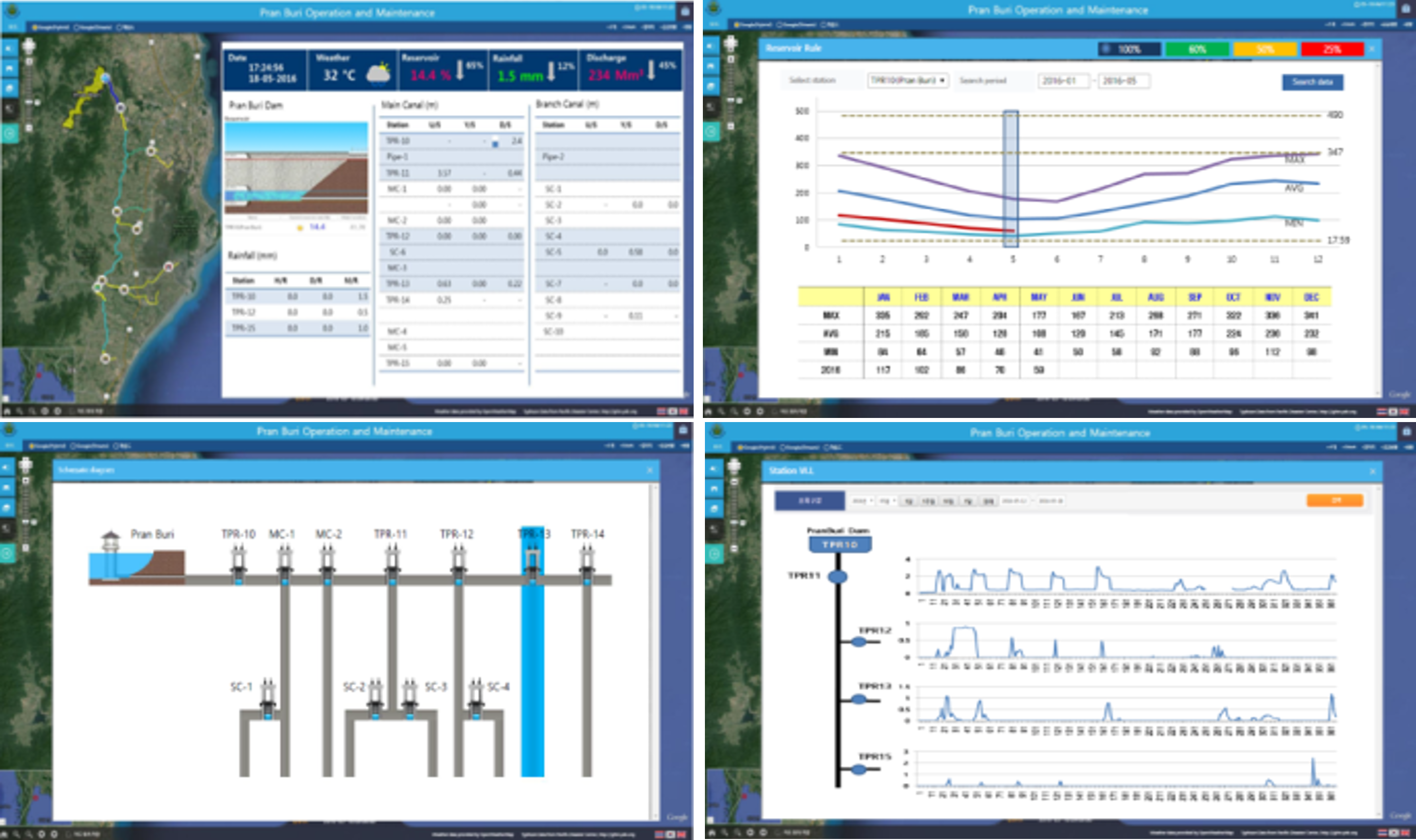
geoHydro for Integrated Water Resources Management
This system establishes a GIS/LBS-based hydrological information management framework to support integrated water resource and smart river management, providing comprehensive maintenance and management services for water resources and river-related facilities based on spatial river data.
Key Features
- Integration of sensors and measurement devices based on IoT platforms
- Real-time monitoring of various sensors and measurement equipment
- Integrated linkage with evaluation models for water use, floods, and droughts
- Visualization of specialized analytical information for water resources data
- Maintenance services for diverse field measurement equipment
- Creation and management of reports by topic and period
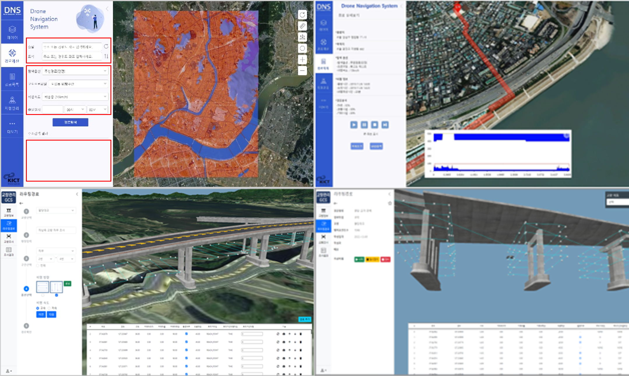
Drone Integrated Control Solution geoFlight
This solution provides integrated drone traffic management for safe flight operations and low-altitude air route planning.
geoMobile Spatial Map Services
This solution delivers optimal location-based field operation services by combining mobile environments with spatial information and LBS technologies, and provides integrated operational environments through linkage with solutions such as geoBoard and geoCommand.